01
Style every meaningful layer
Control colours, roads, water, boundaries, labels, fonts, icons and zoom behaviour in a visual studio built around open map standards.

An Aello Software product · Founding preview
Choose a style, add your locations and publish an interactive map. Start with our managed founding preview and take your work with you through portable exports.
No payments are currently accepted. Preview availability, usage limits and future pricing may change. No permanent free plan or service levels are promised. Preview terms.

The interactive map is unavailable. The preview and location list remain available.
Public city centres: Ottawa (45.4215, −75.6972), Montréal (45.5019, −73.5673) and Québec (46.8139, −71.2080). Label examples use the names available in the basemap; translation coverage varies. Map data © OpenStreetMap contributors; basemap by Protomaps.
Your first map
Choose a style → Add locations → Publish your map.
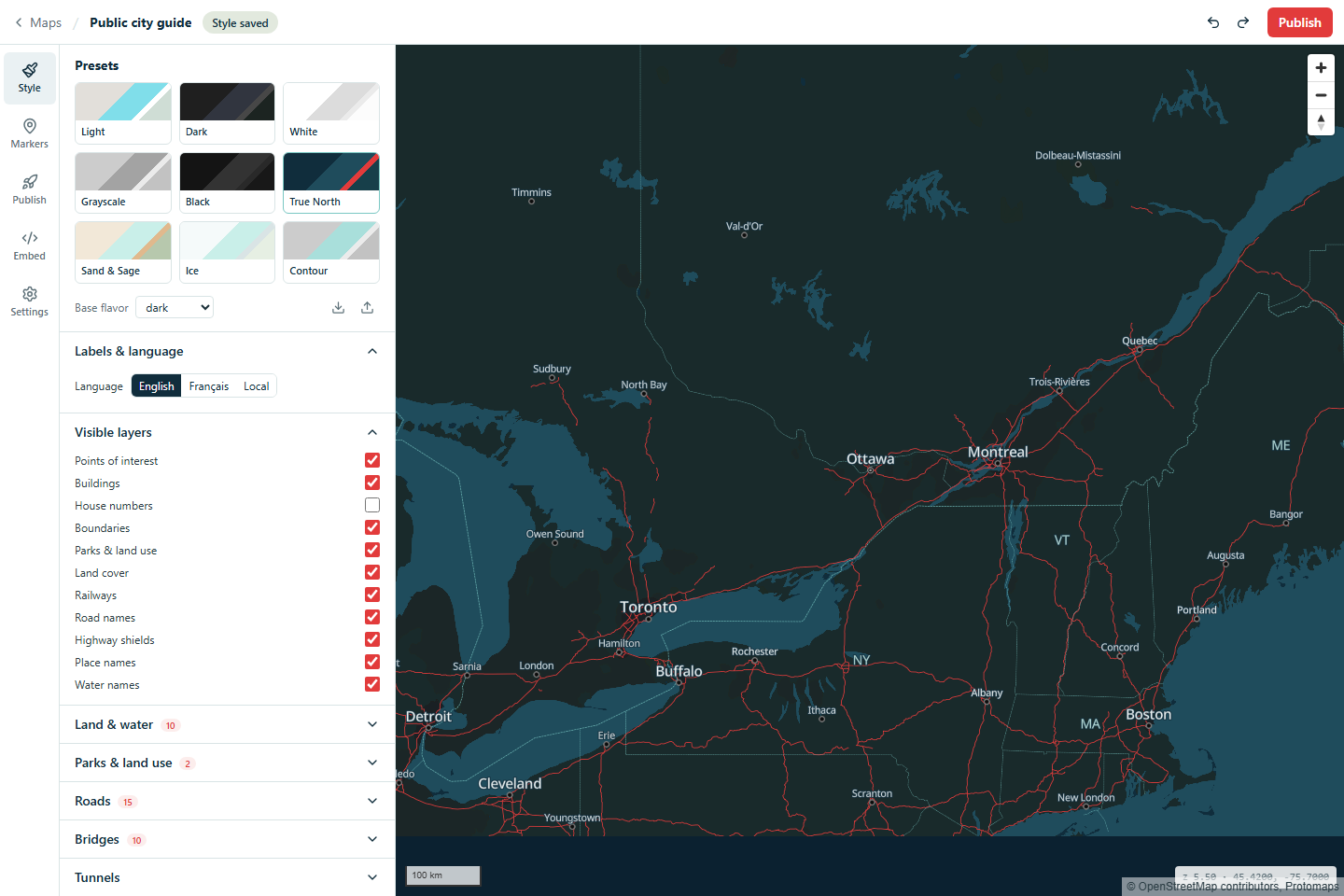
Start from a gallery style, then adjust colours and labels to suit your map.
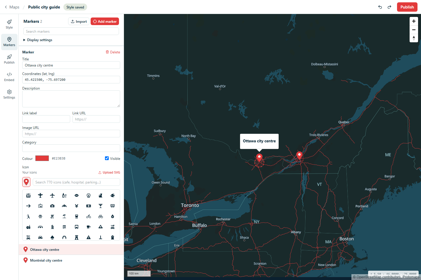
Place a marker or import a CSV or GeoJSON file. Add the details visitors need.
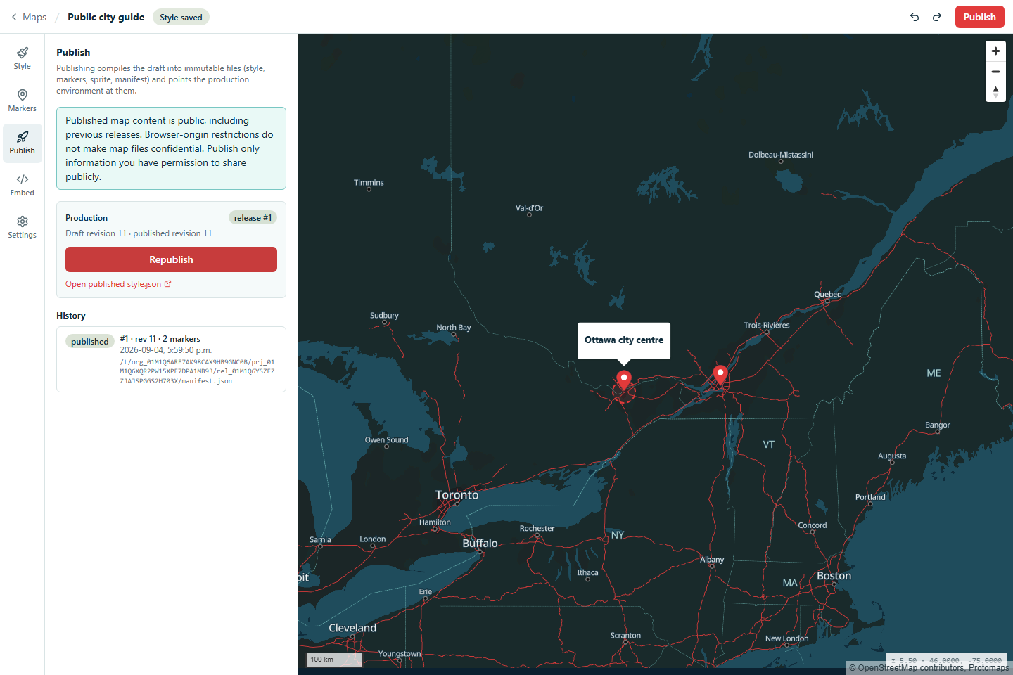
Save your changes, publish a public release and copy the embed into your website.
The platform
Style a shared basemap, add your own locations and publish versioned releases. Place-name approval workflows and authority profiles are planned; they are not available in this preview.
Control colours, roads, water, boundaries, labels, fonts, icons and zoom behaviour in a visual studio built around open map standards.
The founding program will shape authority profiles, review workflows and provenance for protected labels.
Promote a tested map to production, keep an audit trail and return to any earlier release without rebuilding it.
Embed published maps in your website, choose your colours and retain required data attribution. Custom delivery domains are a planned deployment option.
A public Linux x64 self-hosting release is planned. Installation packages and public source downloads will appear here after release verification.
Founding roadmap · Place-name governance
The planned governance layer will build policies from official authorities, language preferences and customer-approved exceptions, storing stable source identifiers instead of brittle text replacements.
# Planned format; not a current Studio feature
feature_id: cgn:FAYLN
jurisdiction: CA
status: official

names:
  en-CA: Lake Ontario
  fr-CA: Lac Ontario

source:
  authority: CGNDB
  record_id: FAYLN

policy:
  approval_required: true
  fallback: hide
Deployment
Choose our managed preview or run the Linux x64 preview on your own infrastructure. Dedicated environments remain under consideration.
The managed founding preview currently operates from Boston, Massachusetts, United States.
Dedicated infrastructure is under consideration for qualified pilots. Availability and requirements need to be agreed before use.
Run Studio and map delivery with public source, versioned containers and a complete installer. Explore self-hosting.
Initial markets
Branded locators, facilities, dealers and regional coverage without a third-party visual identity.
Publish accessible maps with documented data sources, bilingual labels and controlled release cycles.
Carry a consistent visual style across stories, reports and interactive projects. Naming approval workflows are on the roadmap.
Published map content is public. Browser-origin restrictions control the standard embed; they do not make map files confidential. Do not publish sensitive or restricted data.
Founding customer program
The initial pilot is intended for a small number of organizations with a real public map, a need for stronger label or hosting control, and a willingness to provide product feedback.
Questions
It is a replacement for many branded basemap and location-map use cases. The first product does not attempt to replace global turn-by-turn navigation, live traffic or street-level imagery.
Yes. The map component can be replaced independently while the surrounding website, branch pages and external directions links remain unchanged.
The managed founding preview currently runs in Boston, Massachusetts, United States, and data processed there may be subject to U.S. law. A Canadian managed region is not currently available. With the Linux x64 self-hosted preview, you choose and manage your own hosting location.
No. Published styles, locations, map assets and previous releases have public URLs. Allowed browser origins are not an access-control boundary for those files. Publish only content you have permission to make public.
You can export a published map as style JSON and related assets, including your location data. Keep independent backups of your work during the preview.
The current preview uses the available basemap name fields and language settings. Documented authority profiles, protected-name approvals and provenance workflows are planned, not implemented.